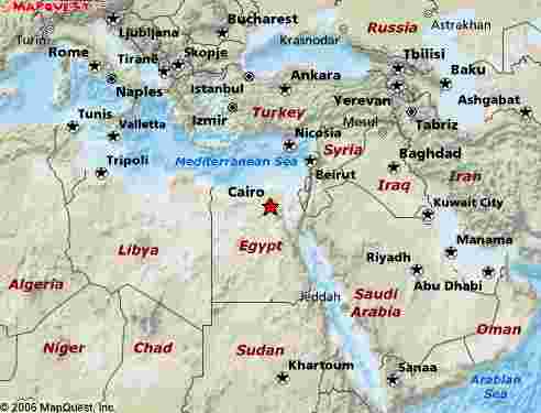
This map is courtesy of Map quest.
ƒ}ƒbƒvƒNƒGƒXƒg‚جƒTƒCƒg‚إڈع‚µ‚¢’nگ}‚ًŒ©‚ç‚ê‚ـ‚·پB
Map quest provides detail map
2008”N8Œژ10“ْ
This map is courtesy of Map quest.
ƒ}ƒbƒvƒNƒGƒXƒg‚جƒTƒCƒg‚إڈع‚µ‚¢’nگ}‚ًŒ©‚ç‚ê‚ـ‚·پB
Map quest provides detail map
2008”N8Œژ10“ْ
پ@ˆب‘OپAپuƒGƒWƒvƒg‰¤‚½‚؟‚جƒiƒCƒ‹ژ،گ…•¨ŒêپEƒtƒ@ƒ†پ[ƒ€پiƒGƒWƒvƒgپjپvپi“Wژ¦ٹظ‚P‚P‚Qپj‚ئ‘肵‚ؤپAƒtƒ@ƒ†پ[ƒ€‚ًژو‚èڈم‚°‚½‚±‚ئ‚ھ ‚ ‚éپB‚¨‚و‚» 4000”N‘O‚ج‰^‰ح‚ئ’ç–h‚ھ‚ ‚é‚ج‚ھƒtƒ@ƒ†پ[ƒ€‚¾پB’ç–h‚ج‚ ‚é’¬‚حƒtƒ@ƒ†پ[ƒ€‚©‚çژش‚إ15•ھ‚ظ‚ا‰؛‚ھ‚ء‚½ƒAƒ‹پEƒ‰ƒtƒ“‚ئ‚¢‚¤‘؛‚¾پB‚ع‚‚ح‚±‚ج‚±‚ج’ç–h‚ھ‚ا ‚¤‚ة‚à‹C‚ة‚ب‚ء‚½‚©‚çپA‘O‰ٌ‚ج“ءڈW‚ج‚ ‚ئپA2“x‚ظ ‚اŒ»’n‚ة‚¢‚ء‚½پBچ،“ْ‚ج“ءڈW‚حپA‚»‚جƒAƒ‹پEƒ‰ƒtƒ“‚ئ‚¢‚¤‘؛‚ھƒeپ[ƒ}‚¾پB
پ@ƒ‰ƒtƒ“‘؛‚ةچs‚‚ة‚حپA‚ـ‚¸ƒJƒCƒچ‚©ƒMƒU‚جƒ~ƒjƒoƒX‚ج”’…ڈê‚إƒtƒ@ƒ†پ[ƒ€چs‚«‚جƒZƒ‹ƒrƒXپiƒ~ƒjƒoƒXپj‚ًŒ©‚آ‚¯‚ؤڈو‚éپB”شچ†‚ھڈ‘‚¢‚ؤ‚ ‚é‚ي‚¯‚¶‚ل‚ب‚¢‚©‚çپA ‹qˆّ‚«‚ً‚µ‚ؤ‚¢‚邨‚¶‚³‚ٌ‚ةپuƒtƒ@ƒ†پ[ƒ€پIپv‚ب‚ا‚ئ•·‚‚ئپA‚ ‚ء‚؟‚¾‚ئ‚©‚±‚ء‚؟‚¾‚ئ‚©‹³‚¦‚ؤ‚‚ê‚éپBƒtƒ@ƒ†پ[ƒ€‚ـ‚إڈ¬ˆêژٹشپAƒoƒX‘م‚ح200‰~‚ظ‚ا‚¾پB ƒtƒ@ƒ†پ[ƒ€‚ة‚آ‚¢‚½‚çپA‚ـ‚½“¯‚¶‚و‚¤‚ةƒ~ƒjƒoƒXڈو‚èڈêپi‚±‚ê‚حƒtƒ@ƒ†پ[ƒ€چs‚«ƒ~ƒjƒoƒX‚جڈI“_‚ئ‚حˆظ‚ب‚éپj‚ةچs‚«پA‚»‚±‚إ‚±‚ٌ‚ا‚حپuƒAƒ‹پEƒ‰ƒtƒ“پIپv‚ئ•· ‚پB‚·‚é‚ئپu‚±‚ê‚ةڈو‚êپv‚ب‚ا‚ئپA‚ـ‚½‹³‚¦‚ؤ‚‚ê‚éپB‚±‚¤‚µ‚ؤ2‰ٌپAƒZƒ‹ƒrƒX‚ًڈو‚èŒp‚¢‚إƒ‰ƒtƒ“‘؛‚ة‚½‚ا‚è’…‚¢‚½پB
پ@4000”N‘O‚ة’z‚©‚ꂽƒ†ƒXƒt‰^‰ح‚ة‚©‚©‚é‹´‚ً“n‚胉ƒtƒ“‘؛‚ة“ü‚éپB‚µ‚خ‚ç‚’¬‚ب‚©‚ج“¹‚ًگi‚ق‚ئپA’¬‚ج’†گS‚¾پBژs‚ھ—§‚ء‚ؤگl‚ھڈW‚ـ‚ء‚ؤ‚¢‚éپBژq‚ا‚à‚½‚؟ ‚ھ‚آ‚¢‚ؤ‚‚é‚ئ‚±‚ë‚ًŒ©‚é‚ئپAٹOچ‘گl‚ح’؟‚µ‚¢‚ج‚¾‚낤‚©پBژsڈê‚ً’ت‚蔲‚¯‚é‚ئپA“¹‚حگg‚جڈن‚ظ‚ا‚ن‚é‚¢چâ‚إڈم‚ھ‚éپB‚»‚±‚©‚çچ¶‰E‚ةژضچs‚µ‚ب‚ھ‚用’n‚ج’†‚ً ’ت‚ء‚ؤ ‚¢‚پB’ç–h‚ھ‚»‚ج‚ـ‚ـ“¹کH‚ة‚ب‚ء‚ؤ‚¢‚é‚ھپA‚»‚جچ‚‚³‚ح”¨’n‚و‚è4ƒپپ[ƒgƒ‹‚ظ‚اچ‚‚¢پB‚±‚ج’ç–h‚ً‚¸‚ء‚ئ•à‚‚ئپA’†‰¤چ‘ ژ‘م‚جƒtƒ@ƒ‰ƒIپAƒZƒ“ƒEƒXƒŒƒg2گ¢‚ھŒڑ‘¢‚µ‚½ƒsƒ‰ƒ~ƒbƒh‚ة’H‚è‚آ‚پB
پ@‚±‚ج’ç–h‚حپAƒ†ƒXƒt‰^‰ح‚ج—¬––‚إ‚ ‚éƒJƒ‹ƒ“Œخ‚ةچ^گ…‚جگ…‚ھ—¬“ü‚·‚é‚ج‚ًژ~‚كپAƒJƒ‹ƒ“Œخ‚جŒخ”ب‚ًگ…–v‚©‚ç‹~‚¢پA”_’n‚ئ‚µ‚ؤٹˆ—p‚·‚邽‚ك‚ةچى‚ç‚ꂽ‚à‚ج ‚¾پBƒtƒ@ƒ†پ[ƒ€–~’n‚ح‚±‚ج’ç–h‚ج‚¨‚©‚°‚إŒأ‘مƒGƒWƒvƒg‚جچ’‘q’n‚ئ‚ب‚èپA‹گ‘ه‚ب’éچ‘‚جگH—ئژù—v‚ًژx‚¦‚½پBƒGƒWƒvƒg‚جچ’‘q’n‚حپAƒtƒ@ƒ†پ[ƒ€–~’n‚ئƒiƒCƒ‹ƒfƒ‹ ƒ^‚ةŒہ‚ç‚ê‚éپB
پ@Œأ‘مƒGƒWƒvƒg‚إ‚حƒsƒ‰ƒ~ƒbƒh‚âچ‹‰ط‚بگ_“a‚ب‚ا‚ج‹گ‘هˆâگص‚ھ’چ–ع‚³‚ê‚é‚ھپA‚»‚¤‚µ‚½ژ–‹ئ‚ًٹ®گ‹‚·‚邽‚ك‚ة‚حپAˆہ’肵‚½گH—ئ‚âگ…‚ھ’éچ‘‚ج‹ڈڈZ’n‚ة‚¢‚«‚ي ‚½‚ء‚ؤ‚¢‚邱‚ئ‚ھ•s‰آŒ‡‚إپAƒtƒ@ƒ†پ[ƒ€‚جٹ±‘ٌ‚ح‚»‚¤‚µ‚½— •û‚ًŒإ‚ك‚éچ‘“yگ®”ُ‚جˆê‚آ‚¾پB‚à‚ء‚ئڈع‚µ‚’²‚ׂؤ‚ف‚½‚¢‚بپB
پ@I did "The Story of Egyptian Kings and the River Nile, Fayoum, Egypt" (Gallery 112) before, which focused on the ancient canal and dyke in Fayum. The dyke is located in a small village called Al Lahun, which is about 15 minutes car ride from Fayum. As this ancient dyke has stuck in my mind, I visited the dyke a few times after then.
To go to the Lahun village, you may go to a regional minibus terminal either in Cairo or in Giza, and there look for a minibus (or as they say, "service") going to Fayum. You may simply ask a driver or a conductor, by saying "Fayum!", and he would direct you to a minibus. In Fayum you need to change to another minibus going in that direction. Taking on two legs of minibus, I arrived at the entrance to the Lahun village.
When crossing on a stone bridge over the 4000 year old Yusuf Canal, the road leads into the central part of Lahun village where there is a busy market. Kids followed me, and I thought that foreigners are still rare here. At the end of the village, the road rises a few meters, and then this road goes on winding. The road is the dyke, and the top of the dyke is about 4 meters above the surrounding farmlands. The dyke goes on a few kilometers and finally goes towards the Pyramid made by Senwosret II in the Middle Kingdom era.
This dyke is part of the hydraulic systems that made Fayum productive in rice and other crops. This dykes stopped flood water of the Nile to enter into the Karun lake which is located downstream of the Canal, and thus helped expose the potentially fertile banks of the lake where irrigation could be done extensively. This made Fayum the Garden of Egypt where agricultural production flourished.
The Ancient Egypt has many a archeological sites to show, but such ancient structure were made possible by stable supply of water and food, and the development of Fayum is one of such endeavors.
ژتگ^‚ًƒNƒٹƒbƒN‚·‚é‚ئ‘ه‚«‚ب‰و‘œ‚ھ‚ف‚ç ‚ê‚ـ‚·پ|
Please click on the photo to view a larger image.
Data <All images are degitized by Kodak Image Pack service.>
162-1 Lahun Village, Egypt, June 2008/ Bessar R Ultron 28mm Fuji RDP III
162-2 Lahun Village, Egypt, June 2008/ Ricoh GR Digital 2 with GR Lens (28mm equivalent)
162-3 Lahun Village, Egypt, June 2008/ Ricoh GR Digital 2 with GR Lens (28mm equivalent)
162-4 Lahun Village, Egypt, October 2007/ Bessar R Ultron 28mm Kodak EB-3
162-5 Lahun Village, Egypt, June 2008/ Bessar R Ultron 28mm Fuji RDP III
162-6 Lahun Village, Egypt, June 2008/ Bessar R Ultron 28mm Fuji RDP III
162-7 Ancient Dyke, Lahun, Egypt, October 2007/ Bessar R Ultron 28mm Kodak EB-3
162-8 Ancient Dyke, Lahun, Egypt, June 2008/ Bessar R Ultron 28mm Fuji RDP III
162-9 Ancient Dyke, Lahun, Egypt, June 2008/ Bessar R Ultron 28mm Fuji RDP III
162-10 Ancient Dyke, Lahun, Egypt, June 2008/ Bessar R Ultron 28mm Fuji RDP III
162-11 Ancient Dyke, Lahun, Egypt, June 2008/ Bessar R Ultron 28mm Fuji RDP III
162-12 Lahun Pyramid, Egypt, June 2008/ Ricoh GR Digital 2 with GR Lens (28mm equivalent)