ナイルを治める者がエジプトを治める、という。しかし、今から数千年前の時代において、ナイルを治めるとはいったいどういう意味だろうか。
Those who govern the river Nile govern Egypt, so they say. But puzzling thing is how - how could an ancient king govern the flow of the Nile without modern technologies?
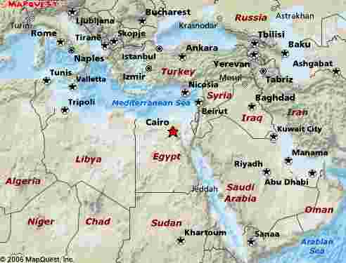
自分がエジプトに行くことになって、にわか勉強で早稲田の吉村先生の「古代エジプト講義録」という本を読んでいた。すると、第12王朝というから今から およそ4000年ほど前の時代に、氾濫期のナイル川の水をカルン湖という湖にためて、その一帯を干拓したという記述と行き当たった。その場所は、カイロの 南のファユームという都市の辺りだという。エジプトに着くと、時間を見つけて、カイロから車を飛ばして行ってみた。
カルン湖は今では海抜ー45mの、地の底にあるような湖で、ナイルから引かれた水は、ユスフ運河という水路で導かれ、オアシス都市であるファユームで細 い水流に分岐して、それがカルン湖の斜面を潤している。ファユーム周辺がエジプトの穀倉地帯となっているのは、このナイルの水を、水が低いところに向かっ て流れるという自然の力で運ぶことができることが大きい。この運河と、水を下流に漏らさないための堤防がおよそ4000年前に建造され、今に引き継がれて いる。
When I knew that I was going to Egypt, I started reading books about the ancient Egypt. One book mentioned that there are an embankment and a canal used for irrigation and land development, dating back to the era of the 12th Kingdom - about BC 1950 or so.. The location is near the city of Fayoum to the south of Cairo. So when I was in Egypt, I set out to see the 4,000 year old irrigation facilities by myself.
Lake Karun, which lies at the bottom of a depression -45 m below the mean seal level receives water from the Nile through what is called the Yusuf Canal. The water runs through the depression and moisten the slope around the lake making the area suitable for agriculture. This is why the Fayoum area even today produces food that is necessary in Egypt. This whole system is sustained chiefly by the civil engineering facilitates that are 4,000 years old.
写真をクリックすると大きな画像がみられます−
Please click on the photo to view a larger image.
Data <All images are degitized by Kodak Image Pack service.>
112-1Lake Karun, Egypt, October 2006/ Olympus Digital Camera
112-2 Lake Karun, Egypt, October 2006/ Olympus Digital Camera
112-3Lake Karun, Egypt, October 2006/ Olympus Digital Camera
112-4 Fayum City, Egypt, November 2006/ Olympus Digital Camera
112-5 Fayum City, Egypt, November 2006/ Olympus Digital Camera
112-6 Fayum City, Egypt, November 2006/ Olympus Digital Camera
112-7 Fayum City, Egypt, November 2006/ Olympus Digital Camera
112-8 Fayum City, Egypt, November 2006/ Olympus Digital Camera
112-9 Al Lahun, Egypt, November 2006/ Olympus Digital Camera
112-10 Al Lahun, Egypt, November 2006/ Olympus Digital Camera
112-11 Al Lahun, Egypt, November 2006/ Olympus Digital Camera
112-12 Al Lahun, Egypt, November 2006/ Olympus Digital Camera